Satellite technology revolutionizes weather forecasting by providing global atmospheric data, tracking storms, measuring cloud layers, and monitoring climate patterns. It offers continuous surveillance, enabling early detection of hazards like hurricanes, fog, and severe thunderstorms. Satellites capture detailed imagery, aiding in predicting microclimates, volcanic activity impacts, and long-term climate trends. This technology combines with radar to enhance forecast accuracy, ensuring communities worldwide are prepared for diverse weather challenges.
In an era where weather-related events are increasingly severe and unpredictable, the role of satellites in forecasting the weather has become indispensable. Satellites offer a unique perspective, capturing vast swaths of Earth’s atmosphere and surface from space, thereby enabling scientists to track and predict weather patterns with unprecedented accuracy. However, the complexity of atmospheric dynamics remains a challenge, necessitating sophisticated algorithms and continuous technological advancements. This article delves into the intricate ways satellites gather data, their pivotal role in global weather monitoring, and how this information is harnessed to provide life-saving early warnings, enhancing our ability to navigate the ever-changing weather naturally.
- Satellite Technology: An Eye in the Sky for Weather Monitoring
- Data Collection: Tracking Global Climate Patterns
- Analyzing Atmospheric Conditions from Space
- Predicting Storms: From Clouds to Catastrophes
- Enhancing Local Forecasts: Regional Weather Insights
- The Future of Weather Prediction: Satellite Advancements
Satellite Technology: An Eye in the Sky for Weather Monitoring

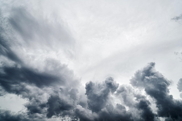
Satellite technology plays a pivotal role in modern weather forecasting, offering an unprecedented “eye in the sky” to monitor and predict atmospheric conditions. These orbiting sensors capture vast amounts of data, providing crucial insights into the Earth’s weather systems. By analyzing imagery and measurements from satellites, meteorologists can track storm developments, monitor cloud layer thickness—a key indicator for severe weather events like hurricanes—and even assess remote areas’ climate patterns, including local microclimates and volcanic activity.
One of the most significant advantages of satellite monitoring is its global coverage. Unlike ground-based observatories, which are limited in scope, satellites provide a continuous, all-encompassing view of our planet’s atmosphere. This capability allows for early detection of potential weather hazards, enabling hurricane preparation tips to be disseminated widely and promptly. For instance, data from satellites can help identify the formation and intensity of tropical cyclones, giving communities valuable time to prepare and mitigate potential impacts.
Additionally, satellites provide invaluable information about the weathering and erosion cycle. By measuring cloud layer characteristics—such as thickness, height, and density—scientists can better understand how these factors contribute to both extreme weather events and long-term climate changes. For example, thick cloud layers can indicate intense precipitation, while specific patterns in cloud cover may signal impending volcanic activity, allowing for more precise weather forecasting and environmental monitoring. This data is especially crucial for regions with unique climatic conditions, such as those influenced by nearby volcanic activity, where local weather can be significantly affected. Find us at [location] for more insights into these dynamic processes.
Data Collection: Tracking Global Climate Patterns

Satellites play a pivotal role in modern weather forecasting by providing continuous data collection from space, enabling meteorologists to track global climate patterns more effectively than ever before. These orbiters gather crucial information such as temperature, humidity, and wind speed at various altitudes, offering a comprehensive view of atmospheric conditions worldwide. By analyzing these data points, scientists can identify emerging trends, like the formation process of fog and thunderstorms, which directly impact weather forecasting techniques.
One of the key contributions of satellites is monitoring barometric pressure readings globally. These measurements help detect low-pressure systems that often signify the approach of storms or front changes, significantly influencing local weather patterns. Advanced satellite technology also facilitates the observation of cloud cover, sea surface temperatures, and atmospheric composition, providing critical inputs into complex weather models. This data integration enhances the accuracy of predictions, allowing for better thunderstorm safety protocols and advanced warnings for potential severe weather events.
As Earth rotates on its axis, satellites provide continuous coverage, ensuring that no part of the globe remains unmonitored for extended periods. This global perspective is crucial for understanding and predicting large-scale climate phenomena. By visiting us at [Earth’s Rotation Influence], you can explore how this natural phenomenon interacts with satellite technology to enhance our weather forecasting capabilities. Ultimately, these advancements in data collection have led to more precise and timely weather forecasts, benefiting communities worldwide by enabling them to prepare for and respond to various atmospheric events.
Analyzing Atmospheric Conditions from Space

Satellites have become indispensable tools in weather forecasting, offering a unique perspective from space that helps meteorologists analyze atmospheric conditions. By orbiting Earth, these artificial eyes capture detailed images and data, enabling scientists to study weather patterns on a global scale. One of their key roles is to observe halos—arising from ice crystals in the upper atmosphere—which can signal upcoming changes in the weather. Understanding these subtle cues is vital for forecasting cloud erosion and dissipation, as well as analyzing atmospheric composition variations.
The data collected by satellites provides crucial insights into the complex interactions within our planet’s atmosphere. For instance, monitoring the movement of fronts, which are boundaries between air masses with distinct characteristics, helps meteorologists predict weather systems’ behavior. By combining this information with other observation methods, such as radar and ground stations, forecasters can issue more accurate warnings for severe weather events like storms and hurricanes.
Advanced satellite technology allows scientists to track changes in atmospheric composition over time. This includes monitoring the concentration of greenhouse gases, which is essential for understanding long-term climate trends. By studying the intricate dance of clouds, halos, and atmospheric layers, we gain a more comprehensive grasp of Earth’s dynamic weather systems. For example, data from satellites has shown how cloud cover influences regional climates, highlighting the complex interplay between the atmosphere and oceans.
To harness these capabilities effectively, it’s essential to have access to reliable data processing tools and expert analysis. By giving us a call at [Brand/NAP], we can help you stay informed with cutting-edge weather insights, ensuring that you’re prepared for whatever the sky may bring.
Predicting Storms: From Clouds to Catastrophes

Predicting storms, a vital aspect of weather forecasting, has evolved significantly with the help of satellites. These celestial observatories provide a global wind patterns overview, allowing meteorologists to track and anticipate atmospheric movements that can lead to severe weather events. By monitoring cloud formations, temperature variations, and humidity levels across vast areas, satellites play a crucial role in identifying precursors to storms. For instance, satellite imagery has enabled scientists to detect the rapid intensification of hurricanes, offering critical time for communities at risk to prepare and evacuate.
The data gathered from these platforms extends beyond weather forecasting to understanding air pollution’s impact on weather and climate. Atmospheric instability, often caused by sudden changes in temperature or humidity, can lead to severe weather conditions like thunderstorms and tornadoes. Satellites help monitor these instabilities, providing crucial insights into the formation of such catastrophic events. Moreover, by tracking the dispersion of pollutants, they offer a global overview of how air quality affects local and regional weather patterns, underscoring the interconnectedness of environmental factors in shaping our climate.
To harness this technology effectively, it’s essential to access comprehensive data sets and advanced analysis tools. Halos, for instance, play a significant role in enhancing satellite imagery resolution, providing meteorologists with sharper insights into atmospheric conditions. By visiting us at Halos, weather enthusiasts and professionals can gain access to cutting-edge resources that facilitate more accurate predictions. This approach not only improves our ability to predict storms but also fosters a deeper understanding of the complex interplay between weather, air pollution, and climate, ultimately enhancing our capacity to protect communities worldwide.
Enhancing Local Forecasts: Regional Weather Insights

Satellites play a pivotal role in enhancing local weather forecasts, providing crucial data for meteorologists to deliver precise regional insights. By observing Earth’s atmosphere from space, these powerful tools offer a comprehensive view of weather patterns, including cloud formation, fog development, and thunderstorm activity. This capability is especially beneficial in regions where weather conditions vary drastically over short distances, such as mountains or coastal areas.
For instance, satellite imagery can track the gradual lifting of warm, moist air masses leading to fog formation. By analyzing this data, meteorologists can predict when and where fog will dissipate, aiding in safety protocols for drivers and aviation. Similarly, polar and tropical climates pose unique challenges. Polar regions experience rapid temperature changes and cloud cover variations, while tropical areas deal with intense heat and humidity that fuel both powerful storms and cloudy conditions. Satellites equipped with advanced weather radar technology can penetrate these clouds to provide data on storm intensity and movement, crucial for issuing timely warnings.
Local forecasts benefit significantly from satellite observations of cloud patterns, which indicate atmospheric instabilities and potential thunderstorm development. By combining this information with surface observations, meteorologists can better predict severe weather events, giving communities valuable time to prepare. For example, snowfalls, a key component of winter weather mechanics, can be tracked from space, enabling advanced warnings for areas prone to heavy accumulation. This proactive approach saves lives, protects property, and helps communities across diverse climates stay safe during challenging weather conditions.
In summary, satellites are indispensable assets in the modern weather forecasting arsenal, offering a bird’s-eye view that complements local observations. By understanding and utilizing this technology effectively, meteorologists can provide more accurate and timely forecasts, ensuring folks are prepared for whatever the weather brings. For tailored weather insights specific to your region, give us a call—we’re here to help.
The Future of Weather Prediction: Satellite Advancements
Satellites have become indispensable tools in the quest to predict and understand weather patterns naturally. Their advanced capabilities, such as capturing high-resolution imagery and collecting data across vast areas, offer a comprehensive view of atmospheric conditions that was previously unimaginable. This section delves into the future of weather prediction, highlighting satellite advancements that are revolutionizing our understanding of the dynamics driving weather.
One of the most striking applications is the observation of halos—ring-like phenomena around the moon or sun caused by ice crystals in high-altitude clouds. These ethereal displays provide valuable insights into cloud structures and atmospheric conditions at different altitudes, contributing to a more nuanced understanding of weather formation. For instance, the presence of halos can signal the development of severe storms, allowing meteorologists to anticipate lightning and thunder events.
Advanced satellite systems also facilitate precise storm tracking methods. By continuously monitoring cloud movements, temperatures, and precipitation rates, these satellites enable forecasters to predict the path and intensity of storms with unprecedented accuracy. This capability is crucial for issuing timely warnings and helping communities prepare for potential severe weather events. For example, NASA’s Geosynchronous Satellite System (GOES) has played a pivotal role in tracking tropical cyclones, enhancing our ability to forecast their impact on coastal areas.
Moreover, satellites are instrumental in monitoring the complex interactions between atmospheric conditions and the oceans. By tracking sea surface temperatures, currents, and humidity levels, these overhead observers help predict weather patterns that influence global climate models. This data is especially valuable for understanding and forecasting extreme weather events like hurricanes and heatwaves, which are increasingly prevalent due to climate change.
In the ever-evolving landscape of weather prediction, it’s essential to recognize the critical role carbon dioxide plays in shaping our atmosphere. As we navigate these environmental changes, leveraging satellite technology to its fullest potential will be key. By combining insights from halos and storm tracking with a comprehensive understanding of atmospheric chemistry, meteorologists can forge ahead in their quest to deliver ever more accurate and timely weather forecasts. Give us a call to learn how these advancements can empower your weather prediction strategies.
Satellites have become indispensable tools for forecasting the weather, offering a comprehensive view of global climate patterns from space. By collecting data on atmospheric conditions, cloud formations, and ocean currents, these celestial eyes enable precise analysis and prediction of storms, enhancing local forecasts significantly. The article highlights the crucial role of satellite technology in revolutionizing weather monitoring, providing insights that drive both global and regional understanding of weather dynamics. Looking ahead, advancements in satellite capabilities promise even more accurate predictions, offering a promising future for safeguarding communities worldwide from the unpredictable nature of the weather.